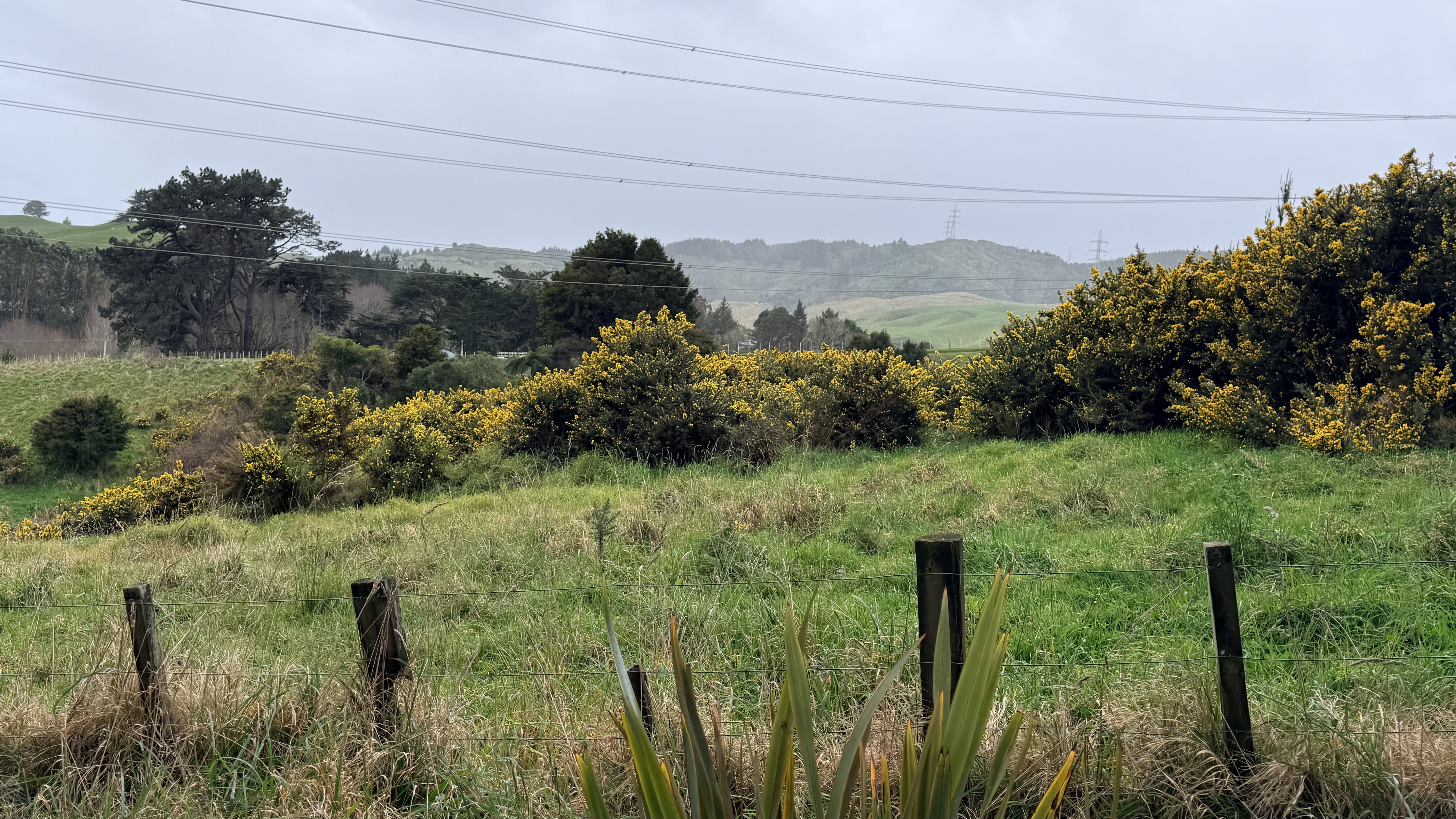
2. Gorse on Wellington Hills
Wellington's terrain is spectacular — and it is precisely that terrain that makes gorse one of the region's most stubborn and dangerous environmental problems.
Wellington is defined by its hills. Steep, wind-sculpted ridgelines frame the city on every side. Suburbs cling to hillsides above the harbour. Lifestyle blocks and small farms occupy narrow valleys and ridgetops beyond the urban fringe. Patches of reserve land, public walkways, and remnant native bush are woven between private properties across the landscape.
This geography — the same geography that makes Wellington visually dramatic and deeply connected to nature — is also what makes gorse so difficult to manage here. The steep, broken terrain that defines the Wellington region is exactly where gorse thrives, exactly where it is hardest to reach, and exactly where the consequences of inaction are most serious.
This page explores where gorse is found across the Wellington region, who is affected, and what is at stake — for suburbs, farms, reserves, waterways, and the thousands of people who walk, run, and cycle through Wellington's hills every year.
The hillside suburbs: living next to the problem
Wellington is one of the most topographically challenging urban environments in New Zealand. Unlike cities built on flat coastal plains, Wellington's suburbs extend up and over steep ridgelines, with houses perched on hillsides, backed by gullies, and separated from reserve land by little more than a back fence.
For thousands of Wellington households, gorse is not an abstract environmental issue — it is a visible presence just beyond the property boundary. Suburbs across the region are bordered by gorse-covered slopes:
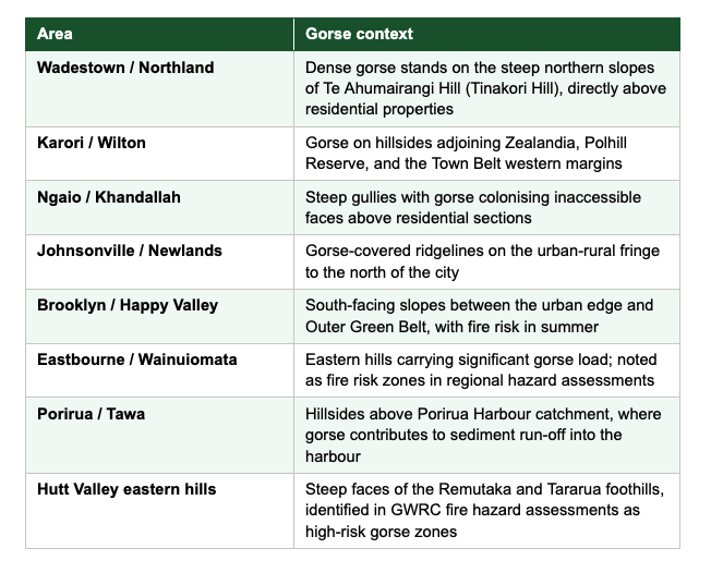
For residents in these areas, nearby gorse creates concerns on multiple fronts: fire risk in dry summers, visual impacts on property values, and the frustration of seeing gorse slowly encroach across reserve land that was once more open or native in character.
Critically, many of these hillside areas sit on land that crosses multiple boundaries — some private, some council reserve, some Department of Conservation land, some in private ownership adjacent to public open space. This fragmented land tenure is one of the central challenges in managing gorse effectively. A landowner who removes gorse from their section may find it re-invading from neighbouring land within a season.
Lifestyle blocks and rural fringe properties
Beyond the urban suburbs, the Wellington region includes a substantial belt of lifestyle block and small rural properties — particularly in the Wairarapa, Kāpiti Coast, Makara, Ohariu Valley, and the hill country around Upper Hutt and Lower Hutt. These properties, typically ranging from a few hectares to tens of hectares, represent a significant gorse management challenge.
Why lifestyle block owners struggle with gorse
Lifestyle block owners often purchase properties with genuine enthusiasm for environmental restoration and land stewardship. But the reality of managing gorse on steep, often rocky terrain — without the machinery, contractor relationships, or specialist knowledge that larger farming operations might have — can be overwhelming.
Common scenarios include:
- Properties purchased with existing gorse cover that sellers did not disclose or did not consider significant
- Gorse re-establishing rapidly after clearing, because of the persistent seed bank in the soil
- Steep slopes that cannot be accessed by conventional machinery, making manual control prohibitively expensive
- Boundary disputes or practical difficulties where gorse spreads from neighbouring properties onto recently cleared land
- Limited awareness of legal obligations under the Biosecurity Act and Greater Wellington's Regional Pest Management Plan
The result is often that gorse management on lifestyle blocks stalls or is abandoned after initial efforts — and what began as a small infestation can cover significant areas of a property within a few years.
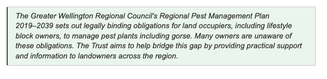
The Greater Wellington Regional Council's Regional Pest Management Plan 2019–2039 sets out legally binding obligations for land occupiers, including lifestyle block owners, to manage pest plants including gorse. Many owners are unaware of these obligations. The Trust aims to help bridge this gap by providing practical support and information to landowners across the region.
Reserve land and conservation areas
Wellington's reserve network is one of its most treasured assets. The Wellington Town Belt, the Outer Green Belt, regional parks including Kaitoke, Pakuratahi, and East Harbour, the ZEALANDIA eco-sanctuary, and numerous smaller reserves provide a connected green framework through and around the city.
But much of this reserve land carries gorse. The reasons are historical — many reserves were previously farmed or logged, and gorse established during those periods of disturbance. Reserve managers at Wellington City Council, Greater Wellington Regional Council, and the Department of Conservation work actively to manage gorse in these areas, but face the same fundamental constraints as private landowners: steep terrain, limited funding, persistent seed banks, and re-invasion from adjoining properties.
The boundary problem
Reserve land does not exist in isolation. It is bordered by private properties, roads, and other land tenures. Gorse that establishes on a reserve boundary — or vice versa — rapidly spreads across the boundary in both directions. Effective management therefore requires coordination across multiple landowners and agencies, not just action on one parcel.
This is one of the Trust's core purposes: facilitating the kind of multi-party coordination that is difficult for any single agency or landowner to achieve alone.
ZEALANDIA and the Kaiwharawhara catchment
A powerful local example of what coordinated restoration can achieve is the ZEALANDIA eco-sanctuary in Karori. Since its establishment in the mid-1990s, the 225-hectare sanctuary has transformed from degraded farmland into thriving native forest — and native species have spread well beyond the sanctuary fence, with kākā, little spotted kiwi, and other birds now recorded across Wellington's broader hill network.
ZEALANDIA's Sanctuary to Sea programme extends this vision to the entire Kaiwharawhara water catchment — aiming to create a healthy freshwater and forested ecosystem, from the hills through the city to the harbour, over the next 100 years. Gorse management on the steep slopes surrounding this catchment is an essential part of enabling that vision.
The Trust's work directly supports the goals of restoration initiatives like this — by tackling gorse on the steep, inaccessible terrain where agency resources and conventional methods reach their limits.
Catchment health: what happens on the hills reaches the water
The hills around Wellington are not just scenery — they are the headwaters of the region's streams, rivers, and coastal waters. Rain that falls on the Tararua foothills, the Remutaka Range, the Rimutaka hills, and Wellington's urban ridgelines flows into streams that eventually reach Porirua Harbour, Wellington Harbour, and the Kāpiti Coast.
Gorse-covered hillsides affect catchment health in several important ways.
Erosion and sediment runoff
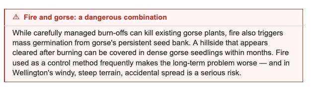
When gorse is cleared — whether by spraying, cutting, or burning — the land can be temporarily left with little surface cover. On Wellington's steep, clay-rich soils, this creates a significant erosion risk. Heavy rainfall can mobilise large volumes of sediment, which then runs into streams and eventually into coastal waters.
Porirua Harbour is a particularly significant example. Elevated sediment loads in the harbour, partly from hill country erosion, have been identified as a long-term threat to the harbour's ecological health. Greater Wellington Regional Council's Te Awarua-o-Porirua Whaitua implementation programme specifically targets sediment reduction as a priority — and hillside vegetation management, including weed control and native planting, is a key tool.
Nitrogen loading from gorse
Gorse is a nitrogen-fixing plant — it takes atmospheric nitrogen and converts it into soil nitrogen, which sounds beneficial but has a downside in the New Zealand context. Research from New Zealand's Manaaki Whenua Landcare Research has found that gorse can fix up to 200 kilograms of nitrogen per hectare annually. In hill country settings, this excess nitrogen can leach into waterways, contributing to elevated nutrient loads in streams and coastal waters.
In catchments already stressed by agricultural run-off, gorse-derived nitrogen adds to the cumulative load on waterways and estuaries.
Loss of natural water retention
Healthy native vegetation — deep-rooted podocarps, tree ferns, and broadleaf forest — holds water in the soil and releases it slowly. Gorse scrub, with its shallower root structure, provides less effective water retention. In a region already prone to flash flooding and drought, the loss of native vegetation from steep hill country has hydrological consequences beyond what is immediately visible.

Fire hazard: the risk hiding in the hills
Wellington's notoriously windy climate, combined with its dry summers and steep terrain, creates conditions for serious wildfire risk. Gorse is the fuel at the heart of this risk.
Greater Wellington Regional Council's own fire hazard assessments have identified that approximately 20 percent of land in the Wellington region — around 165,500 hectares — is at high to extreme risk from wildfires. Gorse-covered hillsides are among the most flammable vegetation types identified in these assessments.
The urban-rural fire interface
Wellington's hillside suburbs sit at what fire experts call the wildland-urban interface — the zone where residential development meets wildland vegetation. When gorse burns in this zone, the consequences can be severe:
- Fires can spread rapidly through dense, dry gorse on steep slopes
- High winds — a Wellington constant — dramatically accelerate fire spread and make aerial suppression more difficult
- Houses built close to hillside vegetation have very limited defensible space
- Access for fire trucks on narrow, steep suburban streets is often severely constrained
The regional hazard assessment specifically identified the southern and western edges of Wellington City, the Ngaio and Ngauranga gorge areas, the eastern Hutt Valley hills, and hills near Eastbourne and Wainuiomata as areas of elevated wildfire risk — many of these are precisely the areas where gorse is most dense.
Learning from Christchurch's Port Hills
A reminder of what is at stake came in February 2024, when the Port Hills above Christchurch burned for three weeks. The fire consumed around 700 hectares, destroyed one home, triggered the evacuation of over 110 properties, and required more than 100 firefighters, 15 helicopters, and multiple aircraft. The Port Hills terrain — steep, gorse-covered hillsides above a major urban area — is directly comparable to Wellington's.
Wellington has not experienced a fire on this scale in recent decades. But the underlying conditions — gorse-covered hillsides, persistent wind, dry summers, and houses built close to vegetation — are all present. Proactive gorse management on Wellington's hills reduces this risk for the entire community.
Hazard for walkers, runners, and cyclists
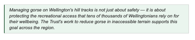
Wellington's hills are a major recreational asset. Hundreds of kilometres of tracks wind through the Town Belt, regional parks, and open hill country around the city, drawing tens of thousands of walkers, trail runners, mountain bikers, and families with children every week.
Gorse affects this recreational use in ways that are underappreciated but genuinely significant.
Physical hazard from thorns
Mature gorse carries dense, rigid spines up to 25 millimetres long. Where gorse encroaches onto tracks — which it does progressively as seed germinates along track margins — it creates a genuine physical hazard:
- Spines cause painful lacerations on exposed skin, particularly arms and legs
- Narrow track sections force walkers or cyclists close to gorse bushes, making injury almost inevitable
- Children are particularly vulnerable due to their height and proximity to gorse at ground level
- Dogs running on or beside tracks can suffer eye injuries and lacerations from gorse contact
- Falls on steep terrain become more serious when gorse is present, both as a hazard that can cause falls and as a surface that walkers land on
Track encroachment and loss
Unmanaged gorse does not stand still at a track margin — it advances. A track that passes through open hillside this year may be partially blocked by gorse next year, and impassable the year after. Track maintenance volunteers and council crews face an ongoing battle keeping popular routes clear of gorse encroachment, diverting time and resources from other restoration work.
In some parts of Wellington's hill network, tracks have been effectively abandoned or rerouted because gorse encroachment made the original route impractical to maintain. This reduces the overall recreational value of the reserve network and can push recreational users onto less suitable terrain.
Navigation difficulty and risk
Dense gorse can disorient walkers who leave the track, whether accidentally or when exploring. In Wellington's often-misty or windy conditions, walkers who lose a track in dense gorse scrub can face a genuinely challenging situation on steep terrain. Emergency services have responded to incidents on Wellington's hills where walkers became disoriented in scrub — gorse is a consistent feature of these environments.
Impact on nature-based recreation experience
Beyond the physical hazards, gorse simply degrades the nature experience that draws people to Wellington's hills. A walk through dense gorse scrub offers little of the birdsong, native plant diversity, or visual beauty of restored native bush. As gorse continues to spread, the nature-based recreational value of the reserve network diminishes for all users.
Who is responsible for managing gorse?
Gorse management in the Wellington region involves multiple agencies and landowners, and the shared nature of the responsibility is one of the reasons it remains an ongoing challenge.
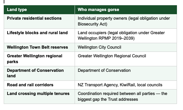
Greater Wellington Regional Council's Regional Pest Management Plan 2019–2039 sets legally binding rules for all land occupiers in the region. The Plan is clear: "The RPMP has clearly defined rules to be met by all land occupiers. It is our responsibility to ensure land occupiers are aware of, and meet, their obligations for pest management on their properties."
In practice, enforcement is difficult and resources are limited. The Trust exists in part to complement the council's work — helping landowners who want to comply but struggle with the practical and financial challenges of managing gorse on difficult terrain.